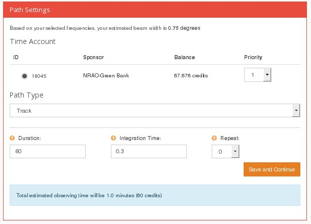
Path Type: Track
The telescope observes one point in the sky. Note the "camera" has only one pixel, so this does not give you an image.
- Track scans are good for observing spectra in high-resolution mode, and for pulsar observing.
- Set the duration in seconds : 60 seconds is good for Galactic hydrogen and strong pulsars.
- Integration time: For spectra, set this to 1 second
- Integration time for pulsar observing : the minimum integration time is 0.00013 seconds. For a good profile, use 1/100th of the pulsar period. That is possible for pulsars with periods greather than 13 milliseconds. One can oberve shorter period pulsars, but you will not get such a good profile.
- Repeat: the track scan will be repeated this number of additional times. For example if the repeat is 2, then it will do 3 track scans, each of the specified duration, in a row. This is pretty much a useless option because 3 scans of 60 seconds each does exactly the same thing as one scan of 180 seconds.
|
 |
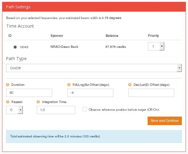
Path Type: On/Off
Observe the object and a reference position some distance away. If doing continuum observations, this is good for measuring the strength (or flux density) of an object. For spectral line observations, it is good for observing fainter objects such as nearby galaxies.
- Duration: time in seconds for each phase. 30 to 60 seconds is usually good for most cases. For observing hydrogen in nearby galaxies, 200 to 300 seconds is a good choice.
- Offset : set this to a few beamwidths, so that the "off" or "reference" position is well separated from the "On" or "Source" position. 3 - 4 degrees is usually a good choice.
- Repeat: repeat the whole scan this many times.
- Note that the total time this procedure will take is the Duration x 2 x (#Repeats + 1)
i.e., if Duration=60 seconds and repeats=2, then it will take 120x3 (=360 ) seconds.
|
 |
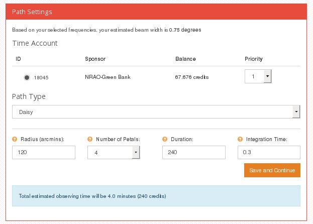
Path Type: Daisy
Use this in the wide-band continuum observing mode.
The daisy map traces a flower-petal pattern. It is good for measuring the strength of a source, and checking if the sky coordinates are correct. One might use a daisy scan to do a preliminary look at an object and then follow up with a raster map.
- Radius (in arcseconds): 90 to 120 arcminutes (i.e, 2-3 beamwidths) are usually good choices.
- Number of petals : use 4 for a quick look; 8-12 for a more complete map.
- Integration Time : 0.2 or 0.3 seconds are usually good for this.
- Duration : 180 seconds for 4 petals and radius up to 180 arcmins; 360 seconds for 8 petals.
|
 |
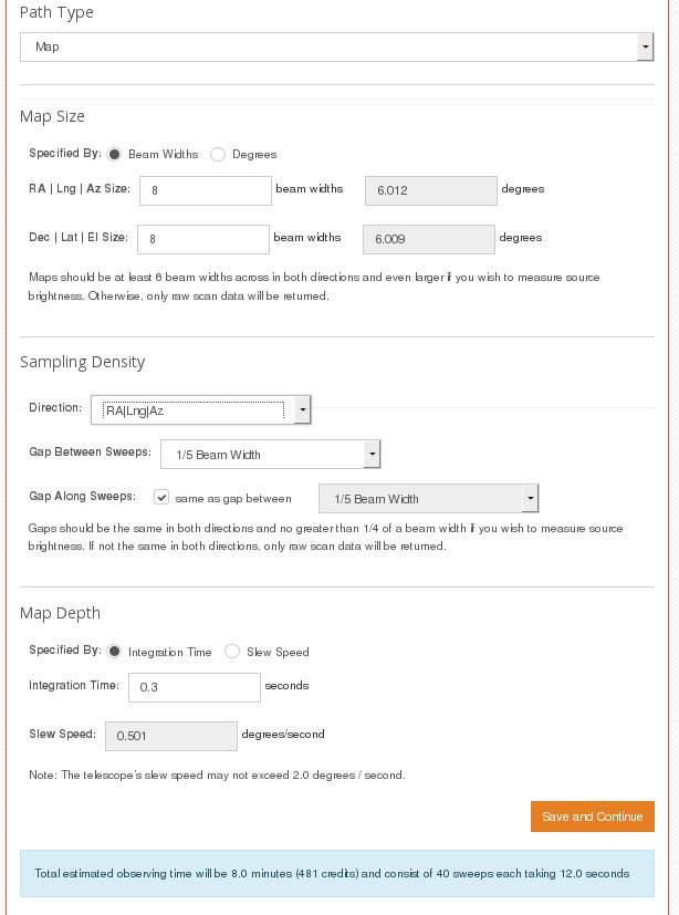
Path Type: Map
The telescope is scanned back and forth to record an image. Use this for wide-band continuum observations.
- Map size may be specified in terms of "Beam Widths" or "Degrees".
- To make a map with enough pixels to distinguish the source from the background, the size should be at least 6x6 beamwidths.
- If you specify the map size in degrees, it will show what that corresponds to in terms of beam widths, and vice versa.
- The scanning direction may be either "RA|Lng|Az" or "Dec|Lat|El". The coordinates that it sweeps along depend on the coordinate system that you chose back in the first screen. If the coordinate type was "RA/DEC" then the sweeps will be along either the RA direction or the DEC direction depending an whether you choose "RA|Lng|Az" or "Dec|Lat|El". It sweeps in the chosen direction, steps in the other direction, then does another sweep, and repeats until the area specified by the map size has been covered.
- Gap between sweeps: use 1/4 or 1/3 beam width for quick or large-scale maps. Use 1/5 or 1/10 for denser and more detailed maps.
- Gap along sweep : if the check mark is there, then the spacing between samples along the sweep will be the same as the gap between sweeps. If the box is checked, the remainder of the options, including those under "Map Depth" will be automatically set to reasonable values and you will get adequate maps. If you uncheck this box, then you can set the gap along sweep to something other than the standard value.
- Map Depth: the system will fill in the right integration time and slew speed. If you want better sensitivity, you can increase the integration time, but do not increase it to more than 2 seconds.
- At the bottom of the page, note the number of sweeps, the sweep duration, and the total duration of the map. Generally you are discouraged from making maps that take more than 30 minutes or so to complete. If you want to map a very big area, it is more efficient to make several smaller maps.
- For some examples, see Mapping/Imaging Advice
- After you click the "Save and Continue" button, it shows a summary of all the inputs; click "Submit" to run the observation.
|
 |
|
What to do after your observation is finished?? consult: Where's my data?
|
 Observing Advice for the NRAO Skynet 20-meter telescope
 Observing Advice for the NRAO Skynet 20-meter telescope


