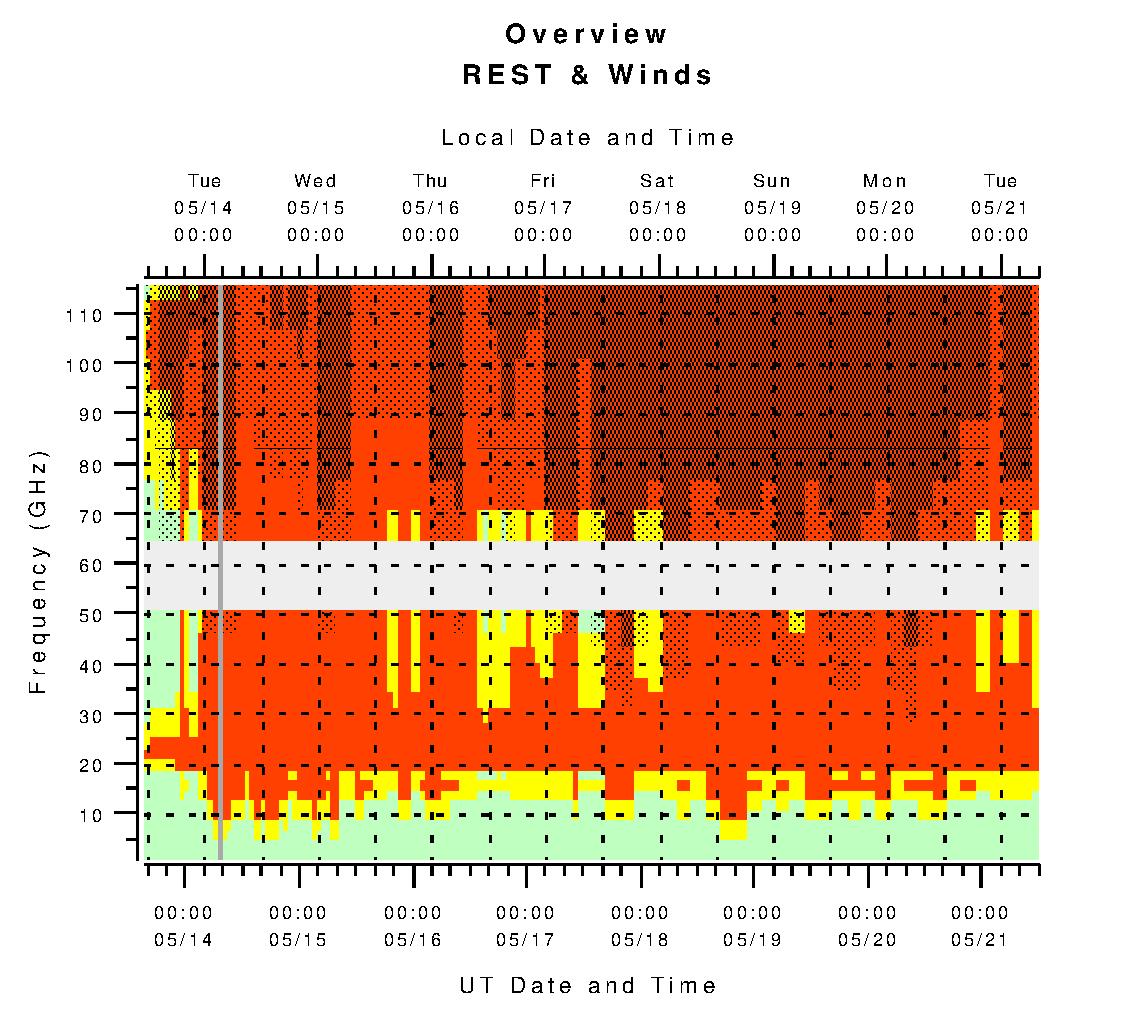
Overview of Rests and Winds:
The above plot presents the values of wind speeds and the Relative Effective System Temperatures (RESTs) for the next 7 days (see below for definitions of RESTs). The forecasts are based on the Green Bank "Point" forecasts for winds and an average of the REST forecasts for Elkins, Lewisburg, and Hot Springs. See the links and descriptions below for more details on these and other weather factors like forecasted cloud cover and precipitation.| RESTs | Good Winds | Usable Winds | Winds Too High |
|---|---|---|---|
| < 1.41 |  |
||
| < 2 at 22 GHz | |||
| < 2, all but 22 GHz | |||
| >= 2 | |||
- A light blue background indicates frequencies or times for which there are no forecasted values.
- The blue vertical line indicates the time when this plot was last updated, usually within the last two hours.
- The values for winds are from the Green Bank "Point" forecasts for the first six days followed by GFS wind forecasts for the last 24 to 36 hrs.
- The suggested wind limits use the PTCS recommendations for good (<5% gain fluctuations) or usable (<10% gain fluctuations) conditions or the telescope's stow wind speeds. We are finding forecasted winds to be a bit pessimistic to what actually occurs.
- The REST values for the first ~3.5-days of the plot are based on NAM forecasts while the remaining ~4 days is based on REST forecasts from the long-range GFS forecasts.
- The suggested RESTs limit for most frequencies is 1.41, which implies one will need twice the integration time as would be needed on the best of days.
- REST>2 indicates needing more than 4x as much integration and are usually not recommended.
- The suggested RESTs limits for 22 GHz is 2 since so little good weather is available at this frequency.