
Movies of the Moon with the GBT
70 cm Wavelength Radar Map of the Moon
Low resolution movie (3.1 MB) | High resolution movie (24.5 MB)
This movie was created from a mosaic of radar images collected using a transmitter at the Arecibo Observatory (AO) in Puerto Rico and receivers at the Green Bank Telescope (GBT). Radar maps can look like optical images, but they represent the amount of energy reflected back toward the transmitter by any given part of the Moon's surface. These maps are created by measuring the echo strength as a function of the round-trip radar time delays and frequency changes (Doppler shifts) that correspond to different locations on the Moon. The radar wavelength of 70 cm penetrates 10 meters or more into the very dry lunar surface, revealing variations in the abundance of rocks larger than about 10 cm in diameter and differences in the chemistry of rocks that form the Moon's crust. The movie begins with a view of the north pole of the Moon - the center of the side we can see from Earth is at top. The rotation carries us around the visible edge of the Moon, past the south pole, the giant Orientale basin, and back to the north pole.

1.6 km resolution view of data for non-polar parts of the Moon.
Click image for high resolution 3.7 MB JPG version.
Additional descriptive material related to the AO-GBT mapping work.
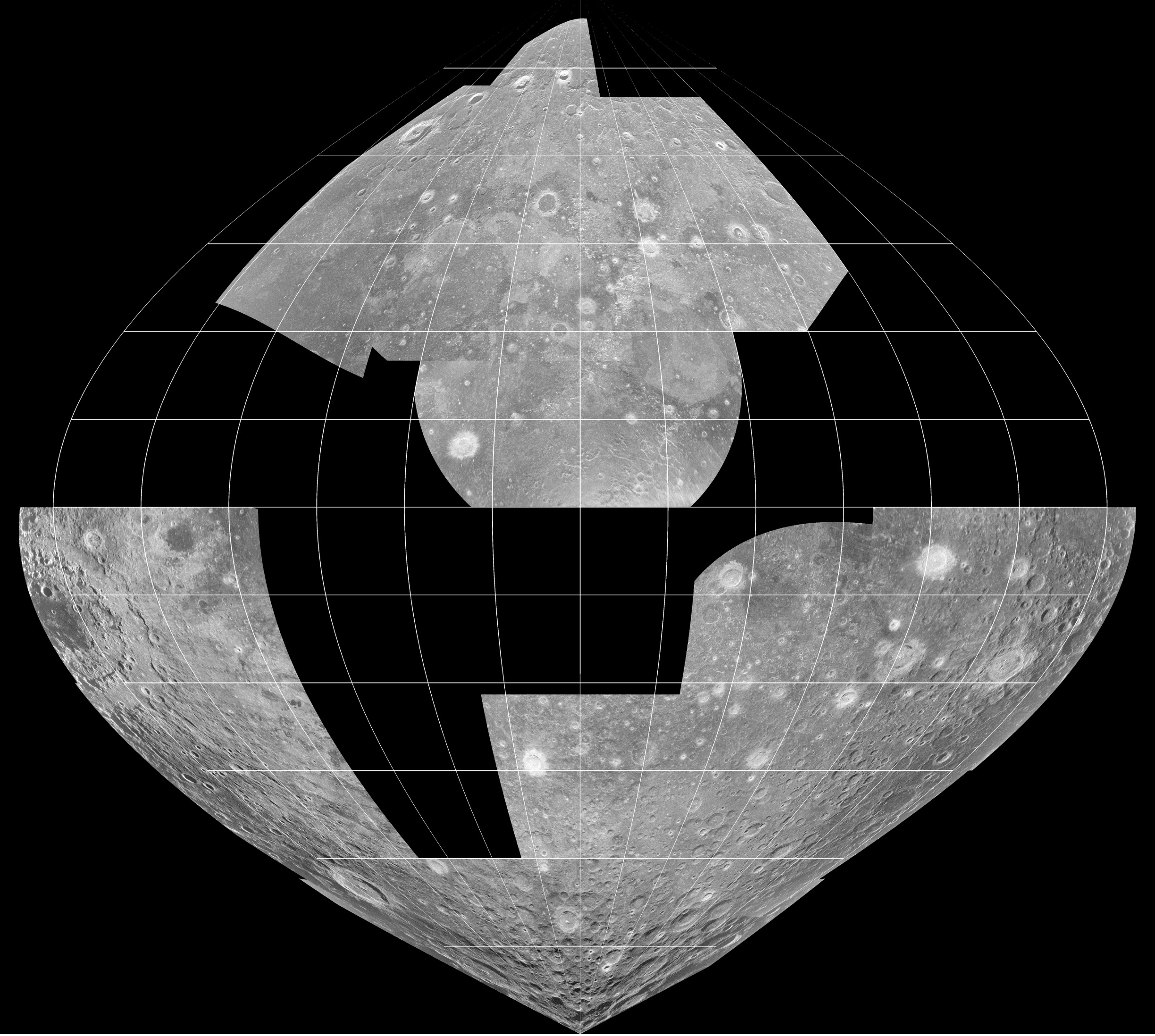
Partial mosaic of 70 cm radar images of nearside of the moon.
Click image for high resolution 1.1 MB JPG version.
Movies and images courtesy of Bruce Campbell, Smithsonian Institution.